Hong Kong elevation data guide
There is high-resolution elevation data available for Hong Kong at a 50cm resolution. The data isn’t too difficult to download, and captures many of the country’s recent land reclamation efforts.
If high-resolution and terrain data aren’t needed, the 30m Copernicus dataset is a high-quality global alternative that’s even easy to work with.
High-resolution datasets
The Hong Kong government has released four DEMs with nationwide coverage:
- A 2020 DSM (recording the values of treetops, rooftops, etc)
- A 2020 DTM (recording the elevation of the terrain)
- A 2010 DSM
- A 2010 DTM
All datasets are at a 50cm resolution in Hong Kong 1980 Grid System coordinates. The dataset is split into a few thousand tiles, though the 2020 and 2010 datasets have different tiling schemes.
Downloading the Hong Kong DEMs
The datasets are available to download through the Hong Kong Geodata Store.
There’s no option to bulk download all of the actual elevation data. But you can download a GeoJSON file for each dataset, which the tile urls can be extracted:
import json


urls = []
with open("CEDD_DTM_2020_20230410.geojson") as f:
    for feature in json.load(f)["features"]:
        urls.append(feature["properties"]["URL"])
then the tiles can be downloaded individually (with a time delay to avoid overloading their servers):
import shutil
import requests
import time

for url in urls:
    time.sleep(10)
    with requests.get(url, stream=True, timeout=60, verify=False) as r:
        filename = url.split('/')[-1]
        with open(filename, "wb") as f:
            shutil.copyfileobj(r.raw, f)
The 2020 files have parentheses in their filenames like this:
9SE24B(e812n812,e813n813).tif
While these are technically valid filenames, they also broke some of the lower-quality software that I typically use to analyse elevation data. I’d recommend renaming them to remove the brackets!
2010 vs 2020 data
At the terrain level, little differs between the 2010 and 2020 data: some noise reduction and processing improvements on the order of a few metres.
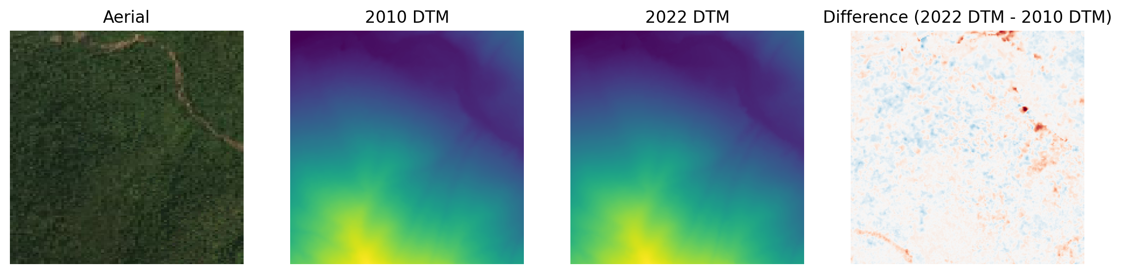 A 400m square, centred at 22.2707, 113.9537
However, Hong Kong has done a lot of construction since 2010, and as a result the 2020 dataset has much better coverage of these infrastructure projects. Here’s the Chek Lap Kok Link, which was completed in 2020:
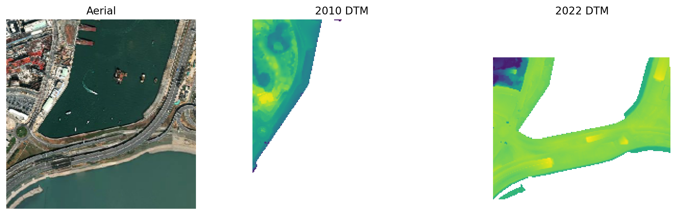 A 800m square, centred at 22.3148, 113.9450
DTM vs DSM
The DSM (Digital Surface Model) does a good job at capturing building footprints and canopy height. In the example below you can see the DSM partially picks up the powerlines running SW to NE: very impressive and not something you often see in country-wide elevation datasets! However the representation isn’t perfect (as expected for something this small), so you may want to further process the DSM to remove noise.
The DTM does a good job of removing buildings and getting down to the terrain: I’d call it Analysis Ready.
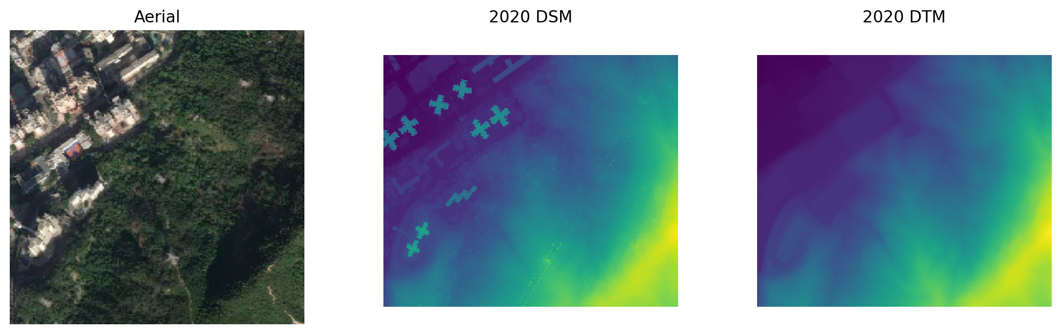 A 700m square, centred at 22.3633, 114.1415
Licence
Hong Kong elevation data is offered under a permissive open licence. Commercial use and modification is allowed, and attribution is required.
Elevation API
GPXZ is an API for high-quality global elevation data. If you need elevation data for Hong Kong, check out our API documentation or reach out at [email protected]!