Terrain tiles API
The GPXZ API now has terrain tiles!
There’s a TileJSON endpoint
https://api.gpxz.io/v1/elevation/tiles.json?api_key=replace_with_your_gpxz_api_key
and an XYZ / slippymap endpoint
https://api.gpxz.io/v1/elevation/tile/{z}/{x}/{y}.png?api_key=replace_with_your_gpxz_api_key
both with support for png and webp images, mapbox and terrarium DEM encoding, and various tile size options to accomodate high-dpi retina screens.

Application
XYZ tiles (and TileJSON) are a standard format for defining terrain map tiles. They’re supported by most geospatial mapping software, and make it easy to migrate from other tile providers such as Mapterhorn, Mapbox or Mapzen.
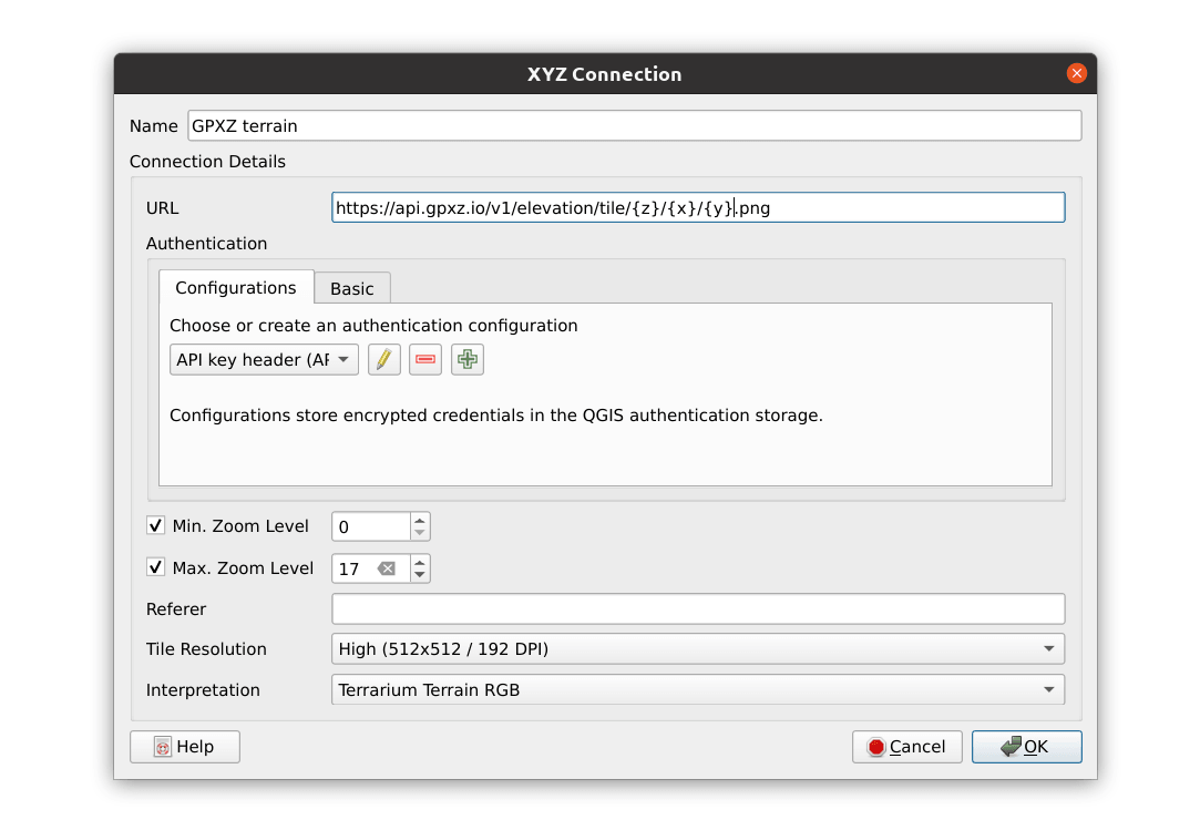
You can add them to GIS software like QGIS for analysis:
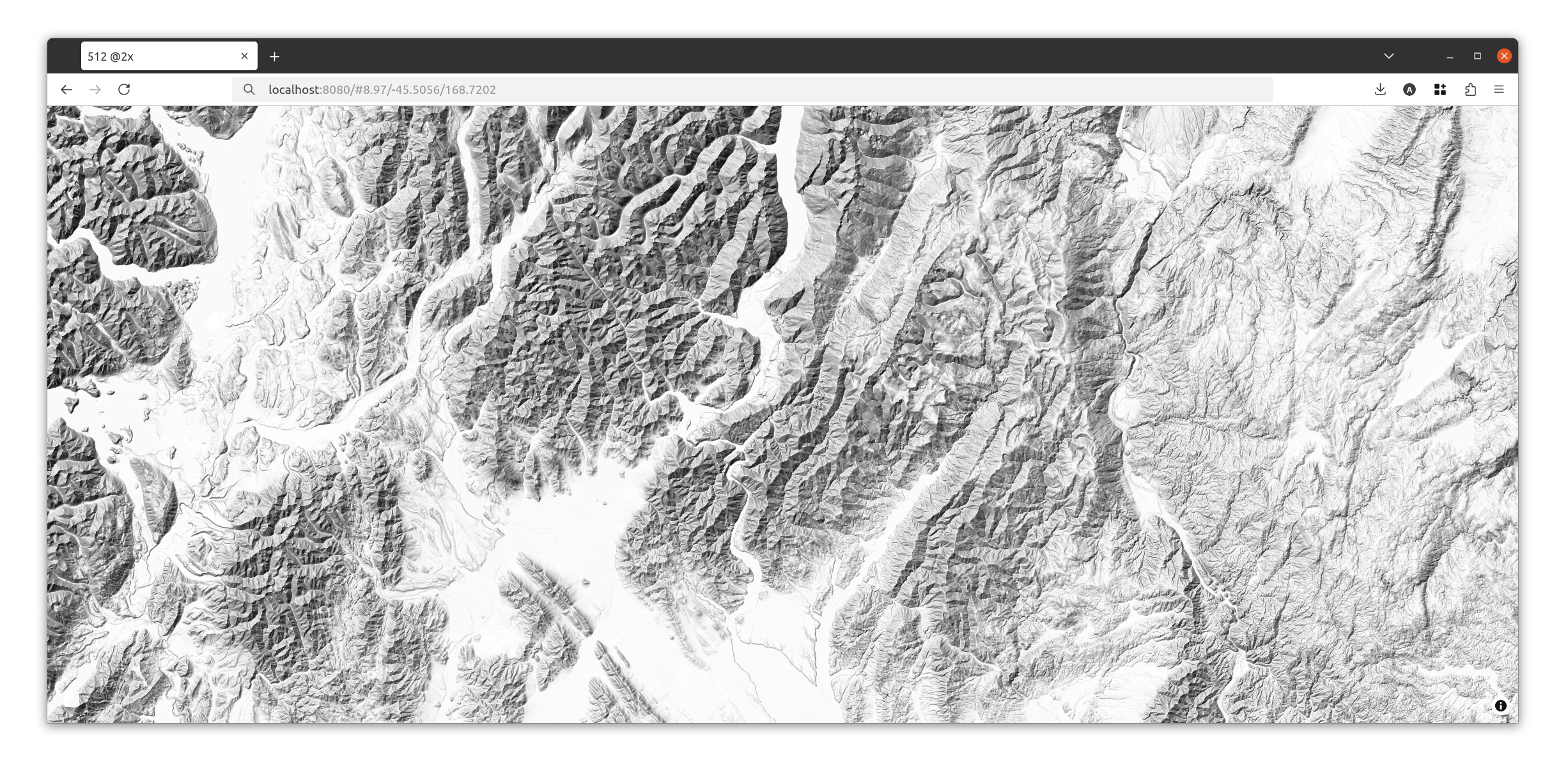
Or use GPXZ data in a webmap with MapLibre
<!DOCTYPE html>
<html lang="en">
<head>
    <meta name="viewport" content="width=device-width, initial-scale=1">
    <link rel='stylesheet' href='https://unpkg.com/[email protected]/dist/maplibre-gl.css' />
    <script src='https://unpkg.com/[email protected]/dist/maplibre-gl.js'></script>
    <style>
        body {
            margin: 0;
            padding: 0;
        }
        html, body, #map {
            height: 100%;
        }
    </style>
</head>

<body>
    <div id='map'></div>
    <script>
        const map = new maplibregl.Map({
            container: 'map',
            zoom: 10,
            center: [11.491, 47.274],
            pitch: 0,
            hash: true,
            style: {
                version: 8,
                sources: {
                    hillshadeSource: {
                        type: 'raster-dem',
                        tiles: ['https://api.gpxz.io/v1/elevation/tile/{z}/{x}/{y}@2x.png?api_key=replace_with_your_gpxz_api_key'],
                        encoding: 'terrarium',
                        tileSize: 512,
                        maxzoom: 18
                    },
                },
                layers: [
                    {
                        id: 'hillshade',
                        type: 'hillshade',
                        source: 'hillshadeSource',
                        paint: {
                            'hillshade-method': 'standard',
                            'hillshade-illumination-direction': 315,
                            'hillshade-shadow-color': '#000000',
                            'hillshade-highlight-color': '#FFFFFF',
                            'hillshade-accent-color': '#000000',
                            'hillshade-exaggeration': 0.5
                        }
                    },

                ]
            },
            maxZoom: 18,
            maxPitch: 85
        });
    </script>
</body>
</html>
Access
Terrain tile access is included in all plans, including the free plan. There’s a different (higher) quota compared to regular API requests.
You’ll need to use an API key with the tiles scope. We recommend creating a new tightly-scoepd API key for each tiles project, and using some of the other methods we have to secure API keys by restricting their use to a certain domain.
Check out the tile API documentation for full details, or reach out to [email protected] with any questions. Happy mapping!