Upcoming GPXZ dataset update (v2023.1)
The new dataset is nearly here!
Queries to api.gpxz.io will return data from the new dataset beginning 2023-10-09 23:59 UTC.
Most customers need to do nothing: new queries will soon start to return improved data. Some customers may want to rebuild processed datasets or re-fetch cached data.
API changes
There is only one API change: all requests will now return a X-DATASET-VERSION header. For now the header will have the value 2023.1 and this will be updated for future dataset releases.
The new sources will be added to the /v1/elevation/sources endpoint. Sources that are no longer used in the v2023.1 dataset will still appear in the endpoint.
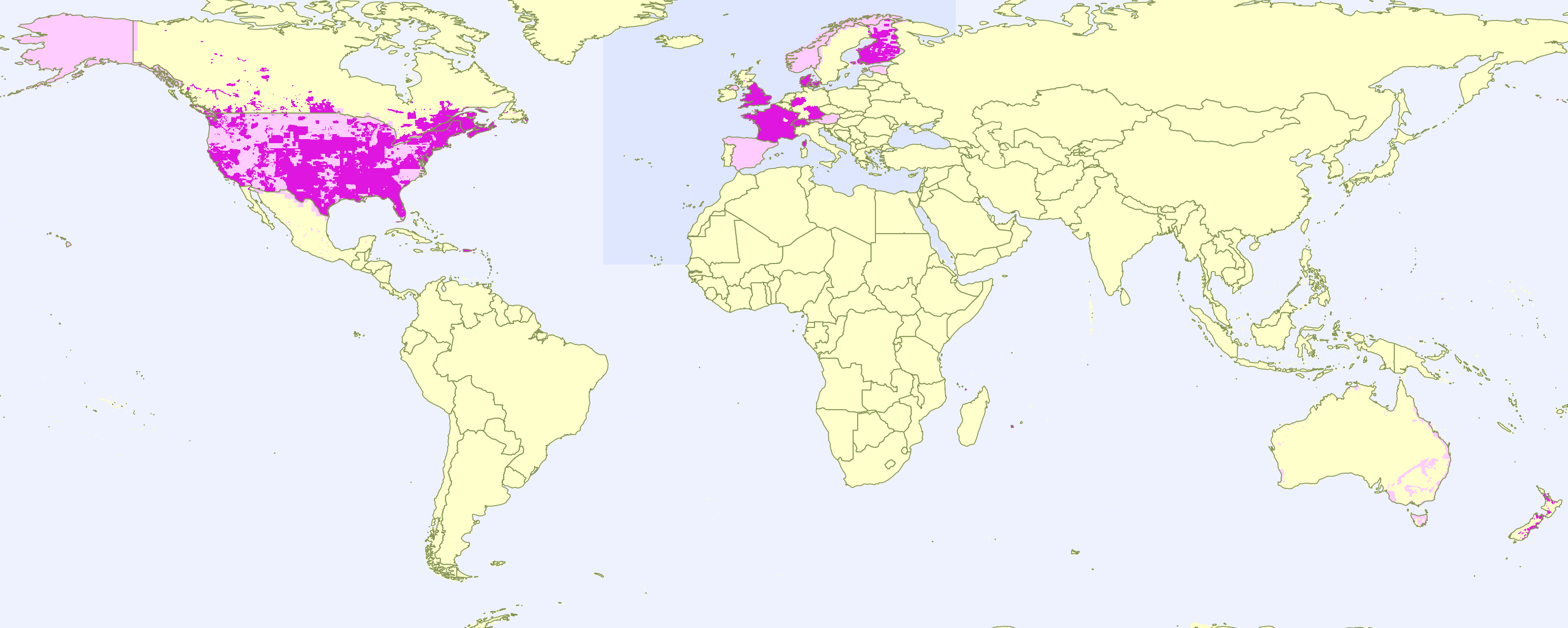
Dataset changes
This is a big update that adds new hires coverage areas, and improves data for existing areas of hires coverage.
New hi-res coverage
- Denmark (whole country, at 1.6m)
- Finland (75% of the country, at 2m)
- France (most of Metropolitan France plus most overseas territories, at 1m)
- Germany (Bayern and NWR, at 1m)
- Hong Kong (whole country, at 0.5m)
- Mexico (small parts, at 5m)
- Norway (most of the country, at 10m)
- Wales (whole country, at 1m)
- Scotland (Edinburgh at 50cm; parts at 2m)
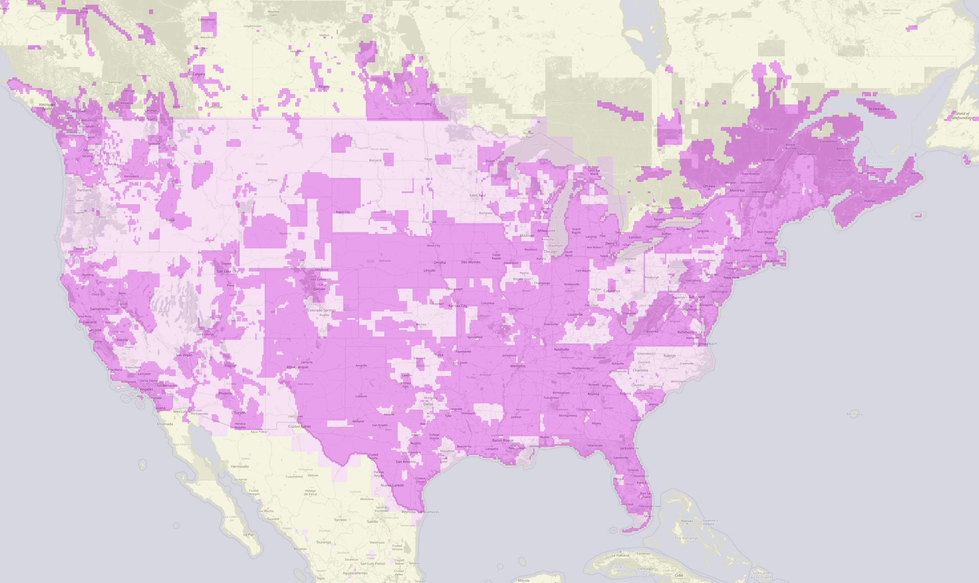
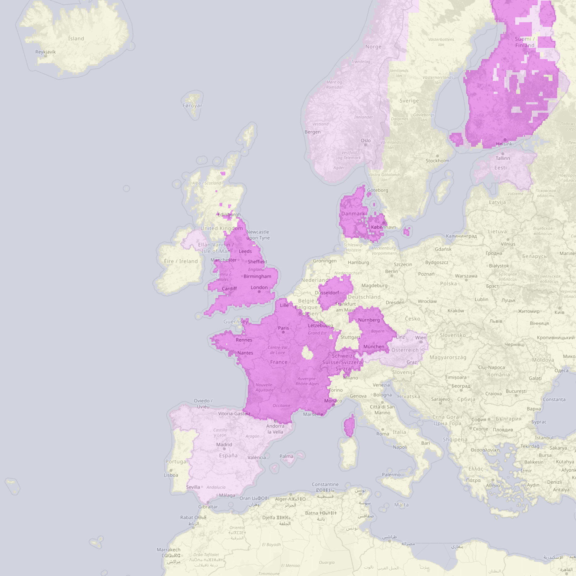
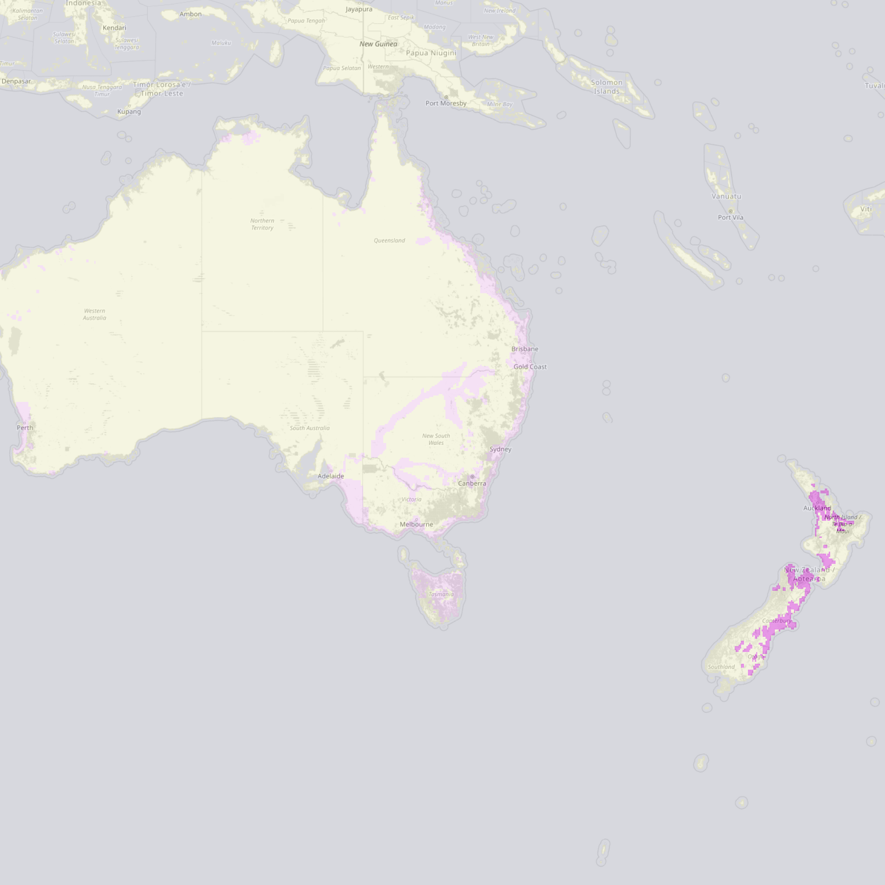
Improved hi-res coverage
- New Zealand (more 1m lidar datasets added)
- USA
- The 10m base coverage for the USA has been updated, resolving many noise issues present outside 1m coverage zones.
- 1m lidar coverage for all of Nebraska, Iowa, Indiana, Mississippi, Tennessee.
- 90%+ 1m lidar coverage for Arkansas, Alabama, Georgia, Florida,
- Expanded 1m lidar coverage across the country.
- Canada (expanded 1m lidar coverage, notably New Brunswick and Vancouver Island).
- GEBCO (wordwide) and EMOD (Europe) bathymetry have been updated to their latest versions (2023, and 2022 respectively).
- England (1m lidar coverage now covers most of the country)
- Spain (5m coverage now covers the whole country)
Other coverage changes
- The 10m Iceland data source has been removed, and Iceland coverage now comes from the 30m Copernicus dataset. The 10m data had numerous issues so while this is technically a reduction in resolution, the new dataset has much better quality in Iceland.
- Many more areas of localised noise/issues have been identified and removed from sources.
Methodology changes
- A new algorithm for coastline detection and lidar ocean removal fixes quality issues within 30m of ocean (where sometimes 30m Copernicus land data is incorrectly used where lidar data indicates water is).
New coverage
Basemaps thanks to OpenStreetMap.