Iceland 10m DTM quality
Note: as of October 2023, with the release of the v2023.1 GPXZ dataset, the 10m Iceland DEM is no longer used in GPXZ.
GPXZ currently uses the 2016 version of the 10m LMÍ Hæðarlíkan 2016 DTM for coverage in Iceland. The dataset covers 100% of Iceland’s landmass, and is an amalgamation of multiple different data sources.
The Hæðarlíkan dataset is on average fairly good quality: it shows close average alignment with other elevation datasets in Iceland, and in many areas (especially over glaciers) the data is sourced from high-resolution lidar surveys down to a sub-metre horizontal resolution.
However, the dataset has some significant flaws in certain areas, which are outlined below. As a result, LMÍ Hæðarlíkan 2016 coverage in South-West Iceland will be removed from GPXZ in the next dataset release.
Notes
- Google Maps results were queried on 2023-03-01, using up to 512 locations per request.
- Plots below show the 2019 release of Copernicus: the next GPXZ release will use a more recent version.
Plateaus and interpolation artefacts
Parts of the Hæðarlíkan dataset (such as the city of Reykjavík) exhibit flat areas of constant elevation where the true topography is undulating. These areas also typically exhibit slopes indicating they were interpolated from very low-resolution data.
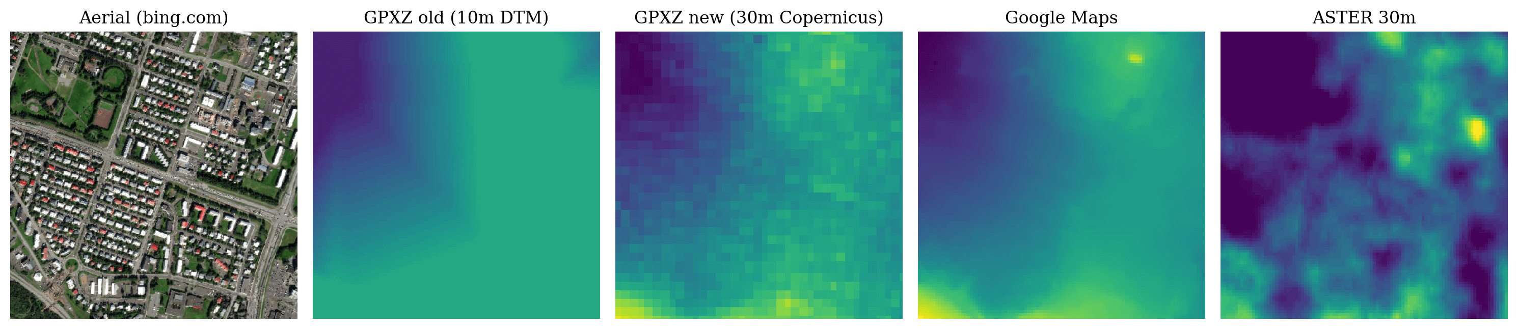 Elevation heatmap of 1km square centred at 64.1344,-21.9074 (Reykjavík)
The same flattening can be seen at Keflavík Airport. The constant elevation is accurate (i.e., close to the true average elevation over that area), but the lack of topological variation is incorrect. The stepping is exaggerated by the Hæðarlíkan dataset being rounded to the nearest whole metre of elevation.
Note that Google Maps and Aster also struggle here.
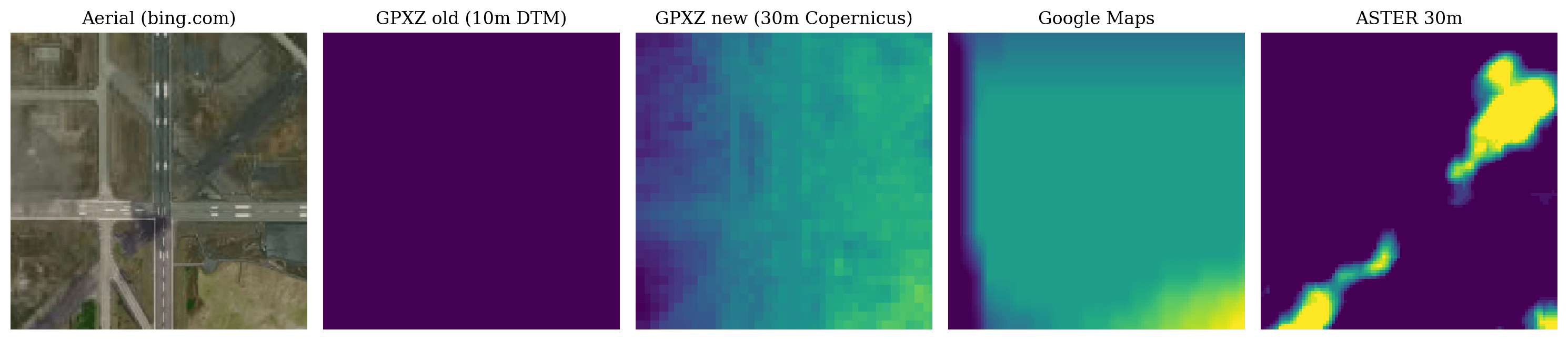 Elevation heatmap of 1km square centred at 63.9859,-22.6058 (Keflavík Airport)
Merge seams
Other parts of the dataset contains inaccuracies where different sources have been merged. These can appear as “pitting” due to algorithmic issues:
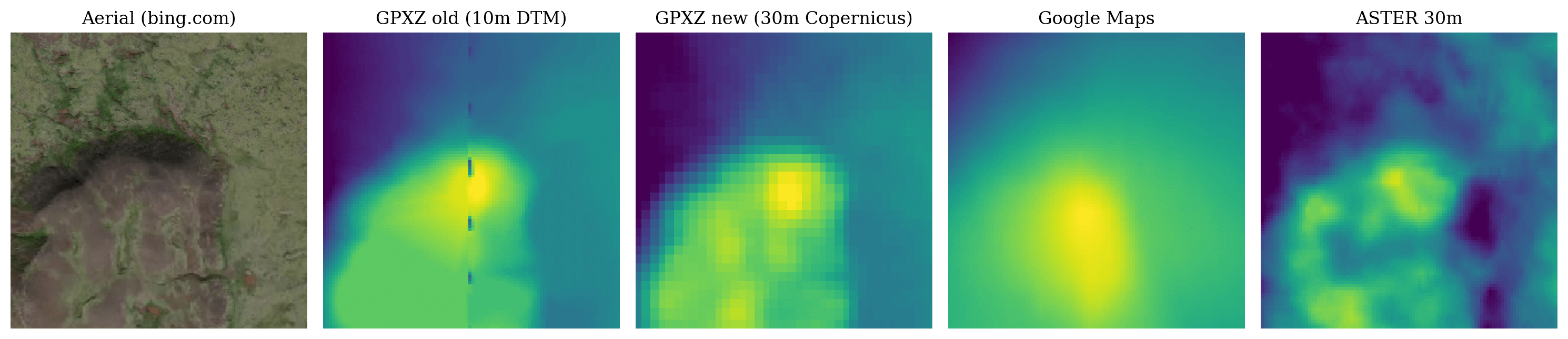 Elevation heatmap of 1km square centred at 63.9270,-22.2496
or as discontinuities due to adjacent sources being slightly misaligned (GPXZ uses a smooth merge algorithm to avoid these issues):
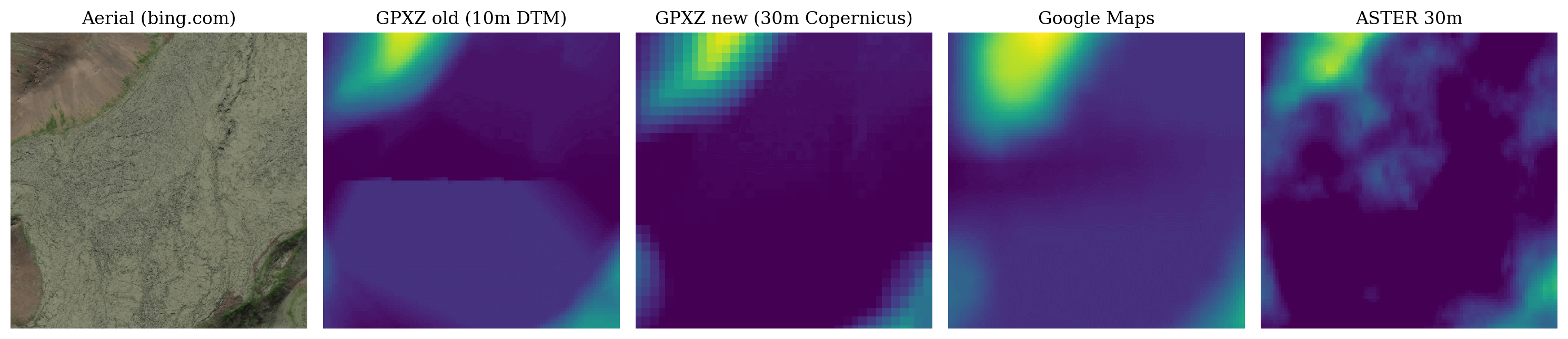 Elevation heatmap of 1km square centred at 63.8747,-22.2063